
Greetings! I am a Ph.D. student in Data Science and Analytics at HKUST(GZ), supervised by Prof. Yuxuan Liang and co-supervised by Prof. Yue Yang and Prof. Yangqiu Song. Previously, I obtained my M.Phil. degree from the same university and my B.E. degree in Computer Science from HFUT.
Currently, I am collaborating closely with Prof. Roger Zimmermann from National University of Singapore, Dr. Hao Xu from Huawei, and Dr. Qingsong Wen from Squirrel AI. Prior to that, I interned at XPENG (supervised by Dr. Cheng Lu) and worked as a full-time Software Engineer at Tencent from 2022 to 2023.
My research focuses on Spatio-Temporal Data Mining, Foundation Models, Time Series Analysis, etc. I aim to build lightweight, adaptive, and practical spatio-temporal systems. I am passionate about translating cutting-edge research into deployable solutions that address real-world challenges.
Feel free to reach out via email if you're interested in discussing research ideas or exploring potential collaborations!
Action required
Problem: The current root path of this site is "baseurl ("_config.yml.
Solution: Please set the
baseurl in _config.yml to "Education
-
 Hong Kong University of Science and Technology (GZ)Ph.D. in Data Science and Analytics ThrustFeb. 2025 - Jan. 2028
 -
 Hong Kong University of Science and Technology (GZ)M.Phil. in Data Science and Analytics ThrustAug. 2023 - Jan. 2025
 -
 Hefei University of TechnologyB.Eng. in School of Computer and InformationSep. 2018 - Jul. 2022
Experience
-
 2012 Laboratories, HuaweiResearch Intern, Spatio-Temporal Foundation ModelsFeb. 2025 - Nov. 2025
 -
 Autonomous Driving Center, XPENGResearch Intern, Multimodal Image-Text PerceptionMay. 2024 - Aug. 2024
 -
 CloudDev Center, TencentSoftware Engineer & Intern, Cloud Intelligent IDEJun. 2021 - May. 2023
News
Publications (view all )
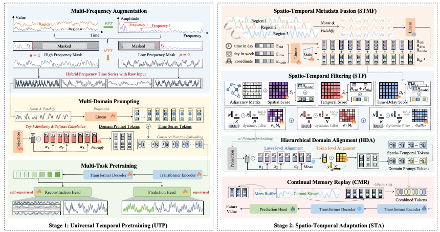
Learning to Factorize Spatio-Temporal Foundation Models
Siru Zhong, Junjie Qiu, Yangyu Wu, Xingchen Zou, Zhongwen Rao, Bin Yang, Chenjuan Guo, Hao Xu, Yuxuan Liang
NeurIPS 2025, Santiago, America Spotlight (688/21,575, 3.19%)

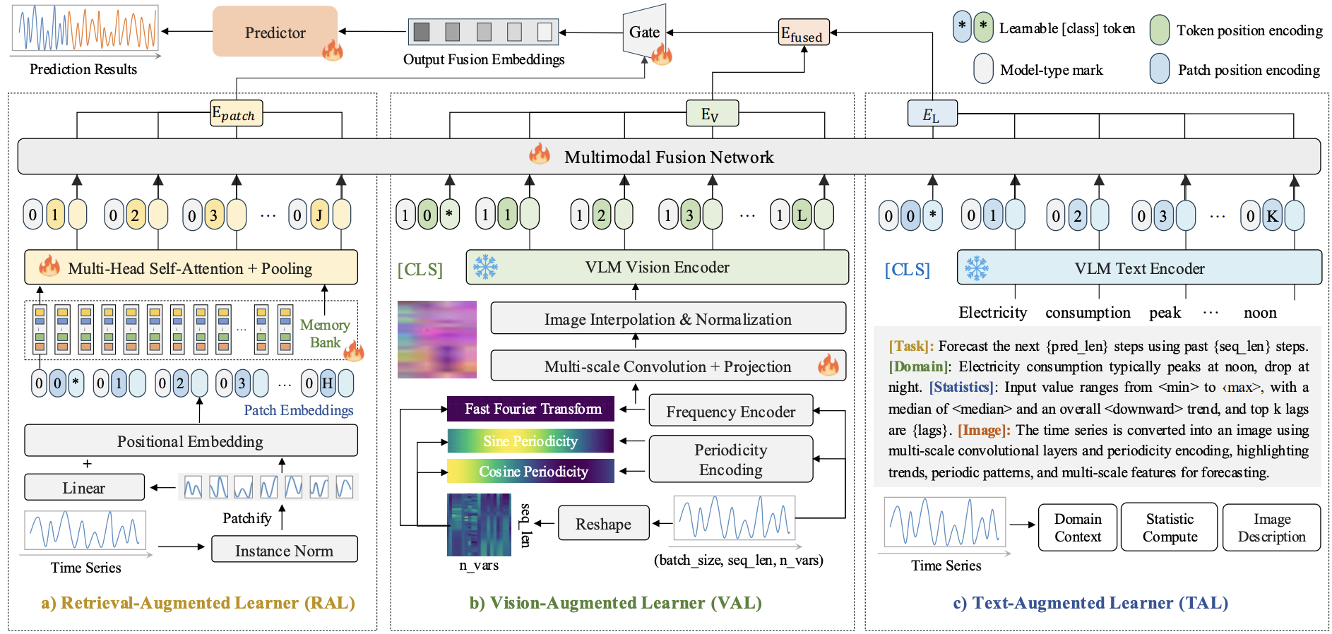
Time-VLM: Exploring Multimodal Vision-Language Models for Augmented Time Series Forecasting
Siru Zhong, Weilin Ruan, Min Jin, Huan Li, Qingsong Wen, Yuxuan Liang
ICML 2025, Vancouver, Canada Poster

Multimodal Learning for Spatio-Temporal Data Mining
Siru Zhong, Xixuan Hao, Hao Miao, Yan Zhao, Oingsong Wen, Roger Zimmermann, Yuxuan Liang
MM 2025 Tutorial, Dublin, Ireland Tutorial

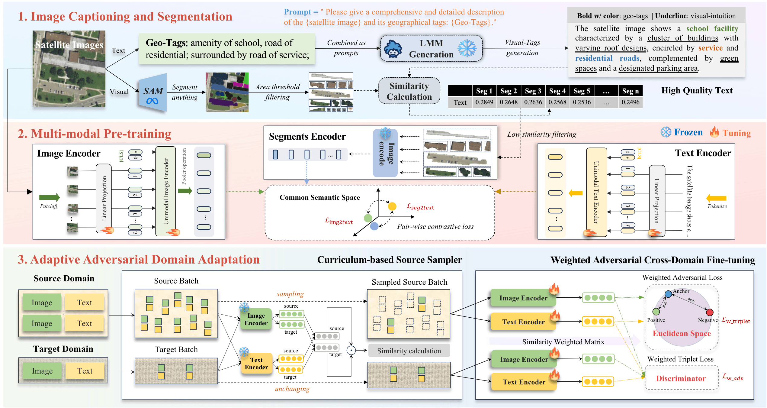
UrbanCross: Enhancing Satellite Image-Text Retrieval with Cross-Domain Adaptation
Siru Zhong, Xixuan Hao, Yibo Yan, Ying Zhang, Yangqiu Song, Yuxuan Liang
MM 2024, Melbourne, Australia Poster

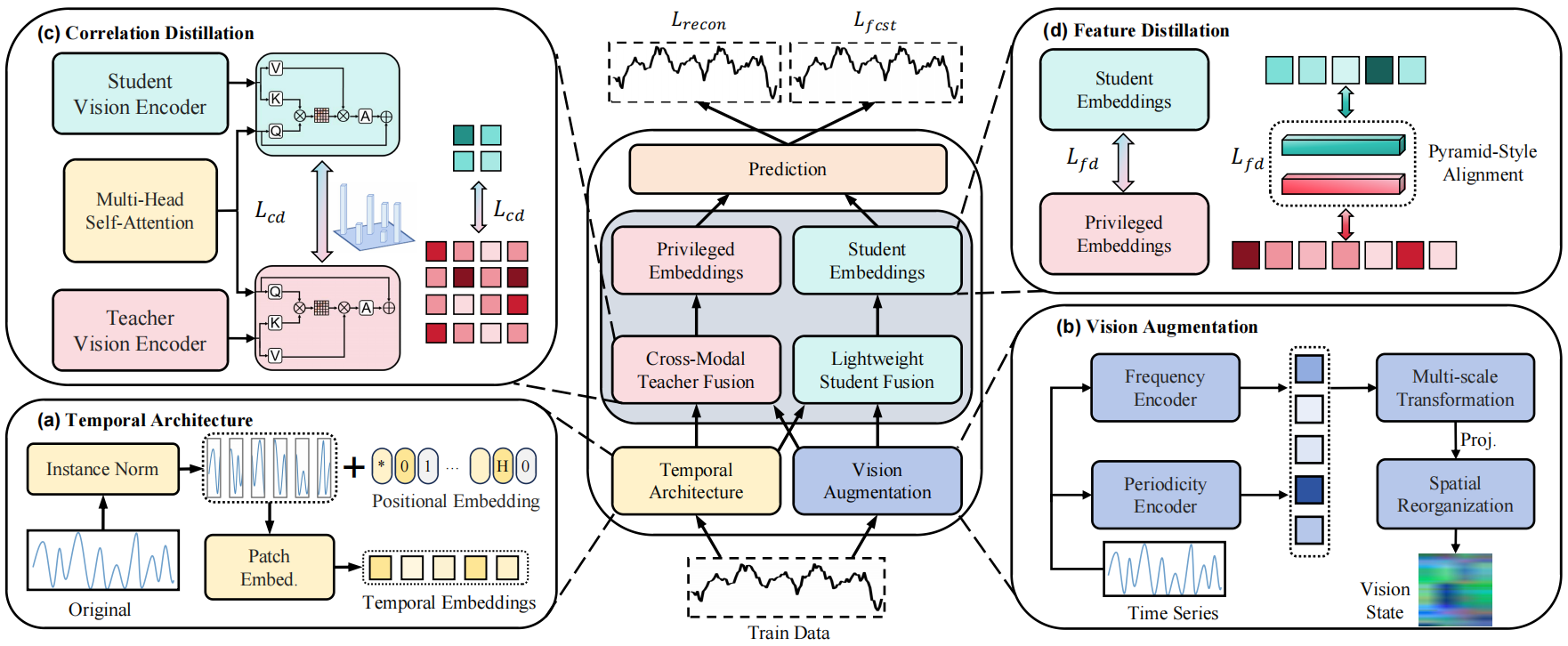
OccamVTS: Distilling Vision Models to 1% Parameters for Time Series Forecasting
Sisuo Lyu, Siru Zhong, Weilin Ruan, Qingxiang Liu, Qingsong Wen, Hui Xiong, Yuxuan Liang
AAAI 2026, Singapore Poster

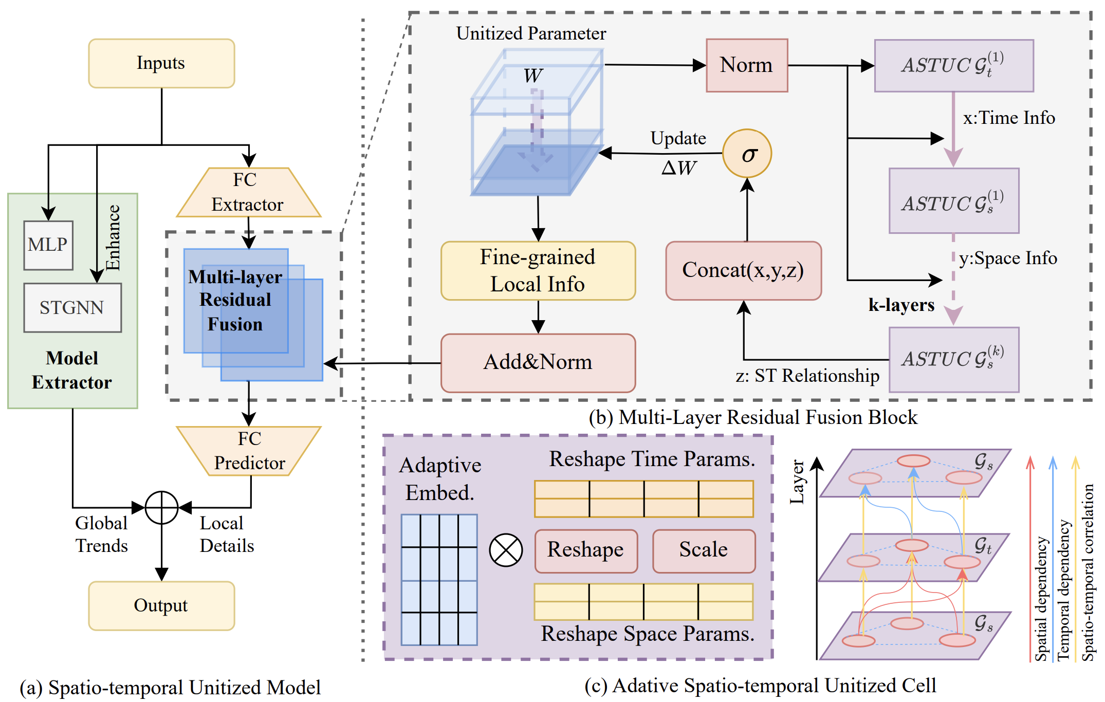
Cross Space and Time: A Spatio-Temporal Unitized Model for Traffic Flow Forecasting
Weilin Ruan, Wenzhuo Wang, Siru Zhong, Wei Chen, Li Liu, Yuxuan Liang
IEEE Transactions on Intelligent Transportation Systems, 2025

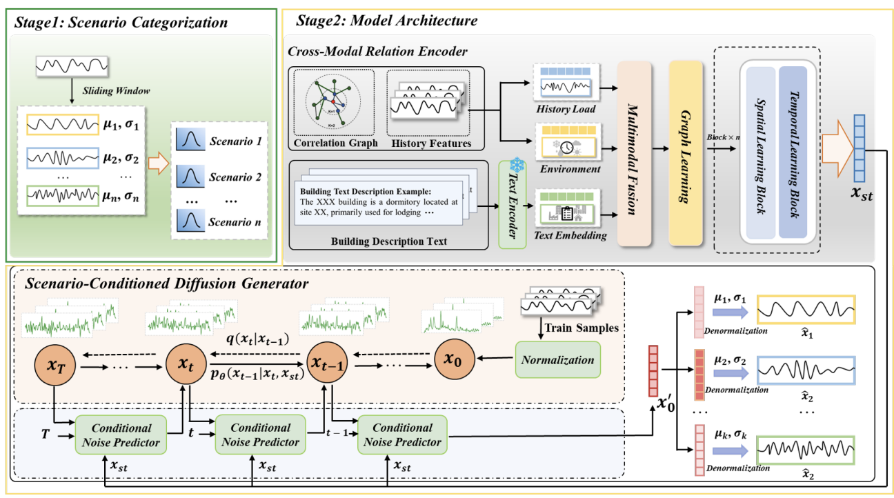
Towards Multi-Scenario Forecasting of Building Electricity Loads with Multimodal Data
Yongzheng Liu, Siru Zhong, Gefeng Luo, Weilin Ruan, Yuxuan Liang
MM 2025, Dublin, Ireland Oral

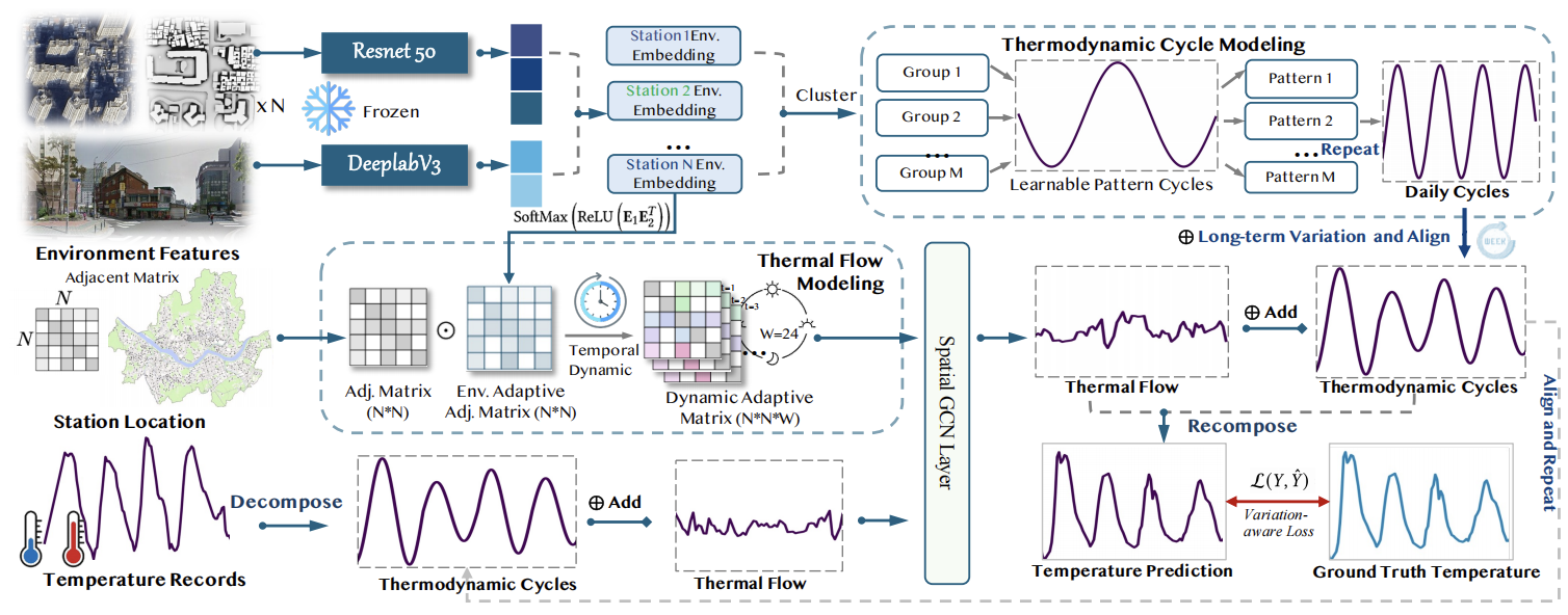
Fine-grained Urban Heat Island Effect Forecasting: A Context-aware Thermodynamic Modeling Framework
Xingchen Zou, Weilin Ruan, Siru Zhong, Yuehong Hu, Yuxuan Liang
KDD 2025, Toronto, Canada Poster

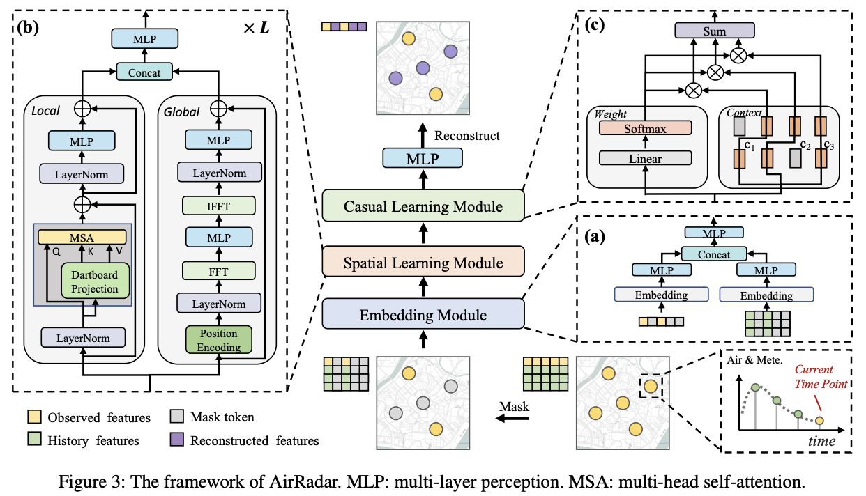
AirRadar: Inferring Nationwide Air Quality in China with Deep Neural Networks
Qiongyan WANG, Yutong Xia, Siru Zhong, Weichuang Li, Yuankai Wu, Shi Fen Cheng, Junbo Zhang, Yu Zheng, Yuxuan Liang
AAAI 2025, Philadelphia, America Poster

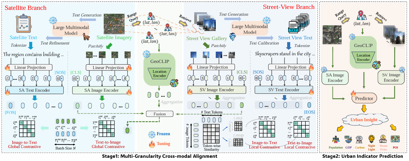
UrbanVLP: A Multi-Granularity Vision-Language Pre-Trained Model for Urban Indicator Prediction
Xixuan Hao, Wei Chen, Yibo Yan, Siru Zhong, Kun Wang, Qingsong Wen, Yuxuan Liang
AAAI 2025, Philadelphia, America Poster

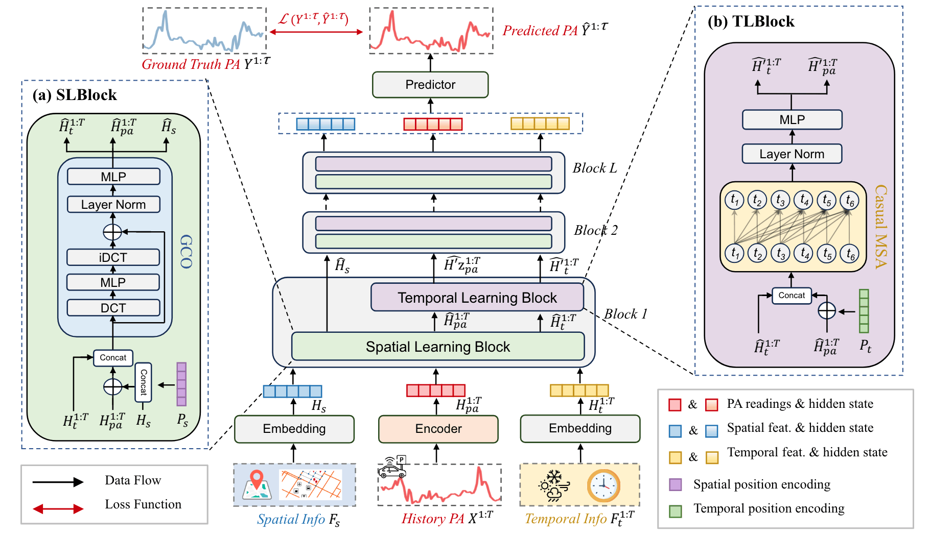
Predicting Parking Availability in Singapore with Cross-Domain Data: A New Dataset and A Data-Driven Approach
Huaiwu Zhang, Yutong Xia, Siru Zhong, Kun Wang, Zekun Tong, Qingsong Wen, Roger Zimmermann, Yuxuan Liang
IJCAI 2024, Jeju Island, South Korea Oral

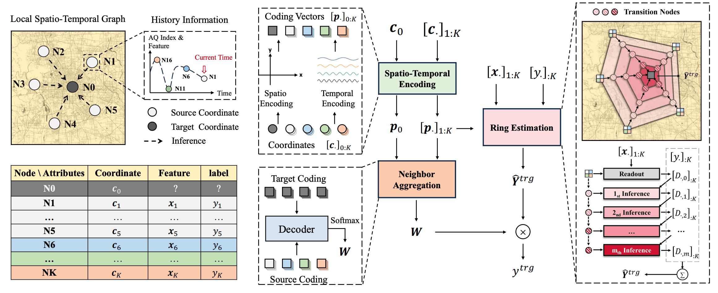
Spatio-Temporal Field Neural Networks for Air Quality Inference
Yutong Feng, Qiongyan Wang, Yutong Xia, Junlin Huang, Siru Zhong, Kun Wang, Shifen Cheng, Yuxuan Liang
IJCAI 2024, Jeju Island, South Korea Oral

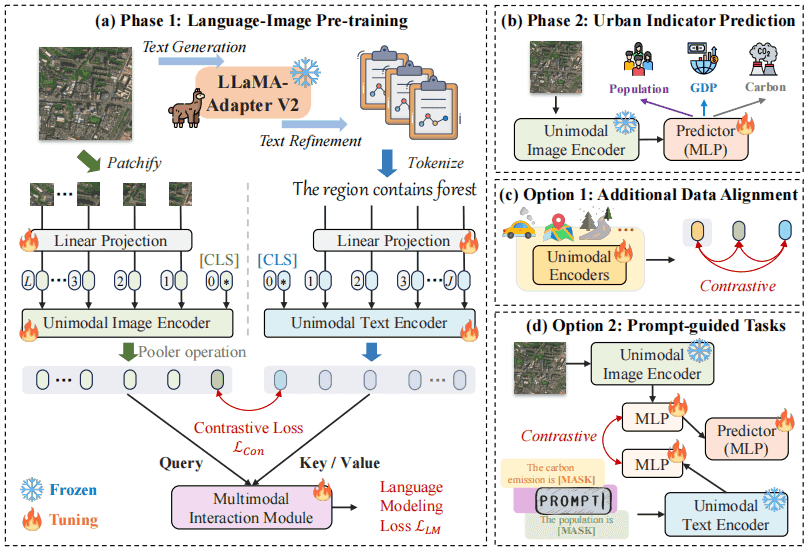
UrbanCLIP: Learning Text-enhanced Urban Region Profiling with Contrastive Language-Image Pretraining from the Web
Yibo Yan, Haomin Wen, Siru Zhong, Wei Chen, Haodong Chen, Qingsong Wen, Roger Zimmermann, Yuxuan Liang
WWW 2024, Singapore Oral
